Sunday, September 6, 2015

My Run Across Maryland - Pen Mar Park MD to Harper's Ferry WV


August 29, 2015


Every other year a group sets out on The Appalachian Trail from Pen Mar Park in Maryland on a trek known as the Hike Across Maryland. It's held the first weekend of May in odd numbered years. It's something I've wanted to do since I learned of it, but a combination of not being able to make my schedule line up and being allergic to hiking in groups, I've never been there. With that said, I've held onto the idea as a fun to-do list item.

With no racing in 2015, this year seemed perfect to complete the 41ish mile journey to Harper's Ferry West Virginia.  Earlier in the year I had proved my navigation short comings and fell short on an attempt to thru-run the 140 mile Horse Shoe Trail. This trek was my only other real adventure I wanted to attempt before the year turned into 2016.

I've had some good running miles this year even with the fact that I've been running simply for the love of it. Heck, in April I logged 232 miles and May gave me 260 miles. For me those are strong months. After that though, vacations, injuries and really the want to be lazy and enjoy summer with Janice and the dogs got in the way of those much needed long runs on weekends. [I don't feel like it's a long run unless it exceeds 20 miles and I hadn't done that since the July 4th weekend.]

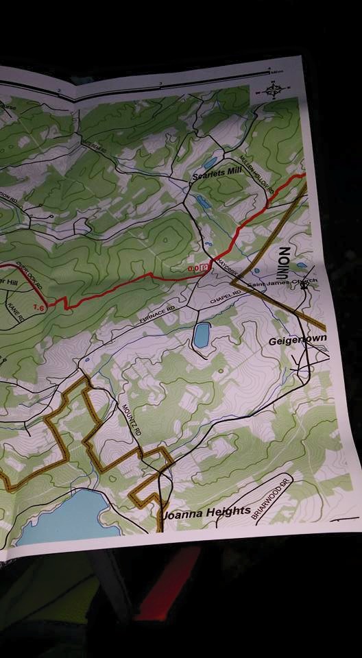
When Janice's softball seasons wrapped up (and by the way, her co-ed team won their league's championship), I threw a dart at the calendar, wiped the dust off of my Appalachian Trail guide books and maps and I decided I was all set to give Maryland a shot. Considering I would be running point to point and water sources in August are questionable I needed Janice's help with resupplying me, not to mention the fact that I would need a ride home. I picked a few points along the way that I felt my hydration bladder would need to be refilled and entered those coordinates into our Jeep's GPS. I also found all the known AT road crossings in Maryland and compiled a bunch of other info in hopes of Janice being prepared to find me and also not get lost. With a start time of 7:00am, I guessed that I could finish in under 10 hours.

I rolled out of bed at 3:30am and got to the business of coffee, some nut butters on toast and a Premier Protein Bar for breakfast. I was hoping to leave around 5:00. Due to a couple of early morning timing stumbles and feeling guilty about waking Janice up, we didn't get on the road until 6:00. No worries though, there would be no race director in Pen Mar Park to tell me that I was too late to run.

For me one of the most important things leading to a successful and fun run is that one last perfectly timed visit to the bathroom prior to starting. A few years ago I had backpacked northbound from Pen Mar to Peter's Mountain and I remembered lovely restrooms at the park and of course my brain had told my bladder and belly all about it. We arrived at Pen Mar and I was all set to visit John, only to find him padlocked. For a park that once had a roller coaster, carousel, miniature train and railroad station, a 450 seat dining hall, and a kickin' dance pavilion, their bathrooms are now padlocked at 7:30am on a Saturday. A mad dash was made to a nearby Sheetz and all was right again in my gastro-intestinal world. 


2015 - Heading Southbound to Harper's Ferry
(Obligatory Photo)
2008 - Heading northbound to Peter's Mountain
(Obligatory Photo)

With an obligatory photograph and a kiss goodbye from my crew, I was running southbound on the trail at 8am. I had not researched the terrain, I had looked at the elevation profile and saw no killer ascents and I of course knew it was just shy of 42 miles to the ATC Office in Harper's Ferry, but I didn't know about the rocks. Being a Pennsylvanian and constantly hearing backpackers whine about our Appalachian Trail rocks, I assumed that certainly the Maryland mileage would be all buffed out and perfect for running.
A few rocks
The first 8 miles or so heading southbound looked just like PA with a climb to High Rock Overlook that was extremely Pennsylvania-like. To add to the climb, at the top; some genius had spray painted the white blazes black and that was enough to send me slightly off course and back-tracking for a short time. I was surprised by the rocks, but it was my own dumb mistake to not know this ahead of time. I also really didn't care though, sure I was going slower than I guessed, but I was exactly where I wanted to be. [Just a note: I have backpacked all of the AT in PA and NJ northbound to Bear Mountain NY and seeing the NJ and NY rocks and now these in Maryland, I'm even more perplexed as to why Pennsylvania gets the bad rock rap]


Vista near High Rock Overlook
The rocks here were covered with grafitti

I crossed a road at about the 8 mile mark and on the other side I nearly ran right into Janice. She had parked the Jeep at the 10 mile mark and set out to meet me. I told her how the rocks had slowed me and apologized for taking so long. She said, "I messed up and I've come too far. You may want to take the key and run on without me." I did that and soon found the Jeep at the Wolfville Road parking area. I drank a couple of ice cold Gatorades and gobbled down a Clif Bar snack. I refilled my hydration vest and stashed the key for Janice to find. I was nearly where the parking lot spur trail rejoins the real trail and there was Janice proudly bounding down the trail, showing off her trail running prowess and Fitbit dominance. Another kiss goodbye and I was moving again.

3 blazes to guide you across the field
(near Wolfville Rd)


The toughest of rocks seemed to be behind me now. Don't get me wrong, they didn't go away, but the trail had become noticeably kinder in portions as I continued southbound. In true AT fashion though, there was one short stretch I recall where the trail was a very runnable double track toddling across the mountain face and with no rhyme or reason the trail took a sharp turn sending you up to the rock strewn ridge. A trail builder's idea of humor I guess. It was a gorgeous day and as I approached Annapolis Rocks, the trail became busy. Day hikers, rock climbers, dog walkers, U.S. Marines training with packs as big as me and suddenly the solitude of the trail was gone and it now was more like running through a Bass Pro Shops.

I was sucking down a Clif Bar gel while striding up a rocky climb only to see Janice approaching me again and again she was a pretty good distance from the Jeep. She gave me the key and off I went and this time it was down a pretty gnarly descent with loose rocks and a bunch of people to contend with. All I could think of was, "wow, she came up this hill, through this mess?". Soon enough, Janice joined me at the I-70 parking area. It was getting hot and humid and the front of the Jeep was in shade so I took a seat on the bumper and enjoyed another cold drink before hitting the trail again.

The Confederate flight south into Maryland from Gettysburg.


When you're bumbling along for hours you have a lot of time to think and muse on stuff without interruption. I had a Pogues song about Gallipoli stuck in my head and while it's down tempo may not have been conducive to running, it seemed perfectly in sync with all my thoughts about the Civil War activity that occurred in this region, namely Lee's retreat from Gettysburg. The Confederates and the Federals divided by South Mountain and now the Appalachian Trail cruises right along its spine.


I also thought a lot about Scott Jurek and our very own thru-hiker, Jeff Lister (aka PA Trailrunner) and thought, "man those guys must've ripped up this section" as I stumbled along. In one rocky stretch, I came upon a woman with just one hiking pole and as we came closer I realized it wasn't a hiking pole at all, she was blind. She was moving nearly as fast as me and I quickly concluded I had zero right to complain about the terrain, my rock pity parties were officially over for the day.


The beginning of the day was a Caterpiller and Inch Worm fest, they seemed to be dangling from every tree. I think I single handedly transported a couple hundred down the trail as they adhered to any part of me they came in contact with.  


After Crampton Gap, my mobile meditation session was joined by thousands of buzzing Mosquitos and Gnats. Horse Flies were landing on me three and four at a time. With those pests joining my journey I was quickly missing all the sticky hitch hikers. Day dreaming can also get you lost, on more than one occasion I was moving along only to realize I had missed a turn. I'm convinced there are more blazes going northbound than south, based on the fact that when I needed to find a blaze more frequently I saw them over my shoulder than up ahead.

Grasshopper in Sunshine

Arachnid


I had told Janice about all the historical stuff along the route. She not only took all these cool photos of it, but she also met me at the Washington Monument, Dahlgren Chapel and the Reno Monument. Seeing her so frequently at points like that is a real lift when you're plodding along in the heat and humidity.

The Washington Monument was closed due to a recent lightning
strike, but it's beautiful vista was still open for business


Me and the Dahlgren Chapel

Dahlgren Chapel


The chapel's ancient steps


The Reno Monument


When we parted at the Washington Monument she had told me she'd see me in 7.4 miles or Gathland State Park. I reached Gathland State Park to see the ruins of an old building, a beautiful memorial to war correspondents and I even saw a woman in a blue sequined dress hop out of a limo with a Mariachi Band, but I didn't see our orange Jeep or Janice. Pleasant autumn-like weather had closed out our week at home and today summer had returned with humid temperatures in the 80's. We had been doing so well and here I was thirsty and hungry and my faithful crew was not there. I had cell signal so I called Janice and of course got her voicemail because she didn't have signal. A kind man who was there Geocaching with his family apologized for overhearing my phone conversation, but kindly pointed out a water pump I hadn't noticed. I was saved. I was putting my pack back together when Janice called. She was already at Weverton Road, the next stop after this one. I had the location and coordinates for Gathland State Park on paper, but forgot to put them in the GPS so her friend Garmin had taken her right to next stop and skipped this one. I told her I had found water and assured her that I was ok and I'd see her at Weverton Road. She pledged she would find a road crossing and meet me.

War Correspondents Memorial Arch


I left out of Gathland State Park thinking about what she said, remembering that this last stretch had no road crossings, zero. I had thought that I would need to get some food in me and maybe even carry a bottle to have extra hydration on this last leg. At the other meeting points, each time I cameled-up by drinking extra while filling my hydration vest. I did use the water pump to fill up, but I took off without drinking extra and I of course hadn't eaten or had that planned extra bottle. It sure was good to see Janice after descending to Weverton Road. I had run out of water about a mile earlier, my watch battery died and so did my cell phone battery, which those two things mean almost nothing really, but they mess with your mind. [I'm not real pleased with the battery in my Suunto watch, I had it on the 12 hour mode and it died at 9.] Of the whole journey, I wanted to take one photo and that was at the Weverton Cliffs. Nope no photo with a dead cell phone battery. Enough of the negatives, Janice had bought peaches from a farmer and gobbling down a Peach was second only to seeing her. At Weverton she told me about a guy she met and that he knew me. After comparing notes I realized she had met Bert Salter's brother Dennis who I met three years ago as we all three left the 59 mile aid station together at The Laurel Highlands Ultra. Unknown to me, Bert and a friend had left Pen Mar two hours ahead of me. It's funny how paths cross sometimes or almost cross as in this case. Leaving out of the Weverton Road parking lot, she told me to "Run!...Fast!", I told her I had "run", but I didn't have "fast".

On my last visit to the C&O Canal Tow Path, I was DNF'ing the C&O Canal 100 so some pretty negative memories came to haunt my run to the footbridge across the Potomac. I was certain I had turned the right direction on the tow path, but blazes are all, but non-existent and this time of year all the trees are leafed out so I couldn't even see any reference points, like the foot bridge I so wanted to simply appear before me. My watch wasn't working so the short jaunt along the canal filled with the most amazing green algae bloom was somewhat of an anxious mind challenge. After winding my way through the tourist clogged footbridge I finally arrived in Harper's Ferry. I saw and followed a few blazes, but soon came to a spot where I didn't see the next one. After a brief scan of the area I realized I needed to look up. Harper's Ferry covers a significant hill side and the trail was now sending me up, up a flight of beautiful stone steps. Those steps led to more steps and so on. The steps seemed endless and when they did end, the steps turned back into a dirt path that continued to mostly climb until it reached the side trail to the ATC Office, which yes you guessed it climbed more stairs. Again, more trail builder humor I suppose. When I reached that fabled old stone building the ATC calls home, my butt was kicked.


It took me just shy of 12 hours to traverse the 41+ miles, so yeah it was a slow day and a long one for Janice, driving, parking and waiting. I couldn't do this stuff without her, it's just that simple and I'll never be able to thank her enough.

My original plan was to have a nice dinner in Harper's Ferry, but the dogs were home alone on a longer day than planned day. Instead,  with a quick change into clean dry clothes I was loaded into the Jeep with a couple of cold ones and with only one stop to pickup Pizza and Stromboli we were home in time to catch Reverend Horton Heat on WITF.

Now it's back to fitting long runs into my weekends, 2016 will be here sooner than I know. :-)


Stuff I used:

Altra Lone Peak 2.0
Injinji Socks
Superfeet Insoles (THANKS Superfeet!)
Zensah Ultra Leg Sleeves
Brooks Sherpa III Shorts (discontinued - my favorite for their pockets)
The North Face Mountain Athletics Sleeveless Shirt (discontinued - got it cheap at the Hagerstown outlet)
Adidas Compression Shorts
Boco Gear ClifBar Visor
Nathan Endurance Hydration Vest (discontinued)
Platypus 2 Liter Hydration Reservoir
Spot Messenger
Suunto Ambit2 S

ClifBar:
Energy Gels
Shot Blocks
Organic Energy Food
Electrolyte Hydration Drink
Mojo Bar
THANKS Clif Bar!

Tailwind Nutrition (300 calories at the I-70 footbridge)
Gatorade (all day - THANKS Jason!)
Huma Gels

Breakfast:
Premier Protein Bar (THANKS Premier Protein!)
Trader Joe's Creamy Almond Butter
Trader Joe's Sunflower Seed Butter


Friday, June 12, 2015

Horse Shoe Trail - A Failed Attempt


I've really been avoiding writing this post. My adventure didn't go as planned and ended prematurely somewhere around the halfway mark. Needless to say, I haven't been excited to write about it.

The Horse Shoe Trail, established in 1935, winds through Southeastern Pennsylvania from Valley Forge National Historic Park through Chester, Berks, Lancaster, Lebanon and Dauphin Counties until it ends up at the intersection with the Appalachian Trail on top of Stony Mountain about 15 miles north of Harrisburg, my home.  The latest map and guide list the trail's length at 140 miles. The trail is maintained by the all volunteer Horse Shoe Trail Conservancy. My plan was to cover the entirity of the trail all in one thru-run/hike in self-supported fashion meaning I would carry everything I needed and refilling water on the go.
The Horse Shoe Trail marker at the start of the trail.

The days and hours leading up to my adventure were peppered with mis-steps. I was on the AT enjoying my last long run before the big day and I caught a toe on a root sending me face/chest first into the rocky trail. I hit hard with my right hand under me. With a mouth full of leaves and dirt I rolled up onto my butt and the world was spinning.  My ribs, back, head, knees and wrists all felt beaten and bruised. The middle finger on my right hand was badly dislocated and I had more than 10 miles to go back to the Jeep (and that was the short cut). Fast forward to Lowe's Home Improvement parking lot just a few days before my start. I saw that the box was labeled as weighing 81 pounds with the picture of two people bending to pick it up indicating you shouldn’t pick it up alone and I picked it up anyway. With a snap and pop and I had sharp stabbing pains in my sternum and the thoracic area of my spine, the areas that hurt most from the impact with the trail earlier in the month. All the healing progress I had made with my hand seemed to not matter now that I couldn’t draw a breathe without pain. May 22nd, after a significant train delay I was now in the Paoli train station being told that it would be at least 90 minutes before a cab could take me to Valley Forge National Historic Park. “You can’t expect me to tie up a taxi taking you to Valley Forge at the busiest time of my day”. The Septa shuttle bus drivers gave similar answers so I took off on foot. I had hoped to hit the trail no later than 9:00 am. After a Ranger and a volunteer told me they had no idea where the Horse Shoe Trail started, I found it myself and started my trip at 10:18am. These mishaps or whatever they were made it seem like someone was telling me not to go.
As I headed up Mt. Misery past the old root beer bottling plant, none of that mattered; I was on the trail and moving. I was now on the trip I had thought about, dreamed about and planned for months. I was stoked to be running my own ultra by my own rules. No official start time, no cut-off times and nobody, but me doing it. No race support like aid stations or reliable trail markings either, but I was now having the fun I had in mind. I was taking on the 140 mile Horse Shoe Trail.
For months a section of trail at the 2.7 mile mark had been closed and I was going to need to find a detour around it. Just days before my start, that portion of trail was opened. Great news, right? I arrived in that neighborhood running on a forested road through beautiful new homes and I noticed a sign stapled to a tree reminding hikers and equestrians to stay on the trail and respect the private property the trail was crossing. I read the nice sign and proceeded up the road. A few hundred feet later I realized I wasn't seeing trail blazes any longer so I backtracked  until I found a blaze. Sure enough I should've turned where I read that sign. I saw no blazes indicating a turn, but no worries I was back on track. Little did I know that this would be forshadowing for the rest of my trek.
This blow-down happened right in front of me right after being lost.
Had I not missed theturn originally, I may have been in danger when this massive tree fell.
Always trying to look on the bright side.

Trails are marked by blazes painted on trees, posts, fences, telephone poles, etc. Blazes let you know you're on the trail and where to turn. I spent the next 30+ hours following the yellow blazed Horse Shoe Trail and unfortunately only covered about half of it, because much of that precious time was spent standing or walking around in circles looking for blazes.

Universal Trail Blaze Definitions

The map and guide saved me a few times, but I also wasted tons of time trying to make sense of the trail on paper versus what I was seeing around me. Missing blazes, upside down turn blazes, backwards signs, etc. became the theme of my day and that was in daylight; the feat of following this elusive trail became even tougher in the dark.
Stopped to change into warmer clothing, get out my lights and take a selfie.

Night time also became a different challenge. Not only was I going slowly trying not to lose the blazes in the dark, but now the sleep monster was on my heals.  Yep, I was getting sleepy. I did attempt a nap twice. Once I slept about 20 minutes and woke up because of the cold temperatures. I thought I'd sleep again by sitting on a log and leaning on a stump. I was asleep about 6 or 8 minutes when I felt something on my right hand. At first I dreamt of our girl dog Mollie sniffing my fingers, but instead I awoke to a small Skunk there next to my hand. I calmly stood up and walked away. The Skunk followed for a few hundred yards until it eventually lost interest. I made no more sleep attempts after that. 

I wear a Suunto GPS watch that stores my track and when uploaded, it displays it on a digital map. That track typically looks like a nice neat line across the map. The map from this trek has points that look as though a child had scribbled the line. Those scribbles are funny to look at now, but it was a terribly frustrating experience at the time.  I really only went about 7 miles out of my way, but the time I wasted trying to figure it all out was extensive. That wasted time put me so far behind schedule, it changed my whole attitude towards the adventure to the point that I stopped in Denver, PA. I'll return to Valley Forge and The Horse Shoe Trail with a pack full of lessons-learned and Janice's support and complete it some day very soon.
I'm not going to bash The Horse Shoe Trail Conservancy for poor trail markings, nor am I going to continue about how badly I was lost. The navigation was on me - period. I'd rather talk about things that went well.


In 2011 the Horse Shoe Trail Conservancy republished their Guide Book and Maps and it's a huge improvement over the old edition. The map is on 10 seperate maps with the key guide book descriptions printed on the reverse side, which allows you to leave the actual guide book at home. As I moved, I kept the current map handy and I found myself using it far more than I've ever used any other trail map. One observation though that should've been a hint is that each map lists it's own mileage, as in each map starts with 0.0 with no cumulative trail mileage and it's only measured East to West. That should've tipped me off that maybe this trail isn't meant to be done as a thru-hike and certainly not in a hurry. The maps are great, but they even contributed to the confusion at some of the intersections where I couldn't tell my right from my left. In any event, if you're doing any of this trail's mileage I highly recommend buying the map set. The proceeds support the Horse Shoe Trail Conservancy.  Note - on my journey I was also beta testing a phone app for the trail conservancy. Although I only used it sparingly in favor of the paper version and in the interest of saving my mobile phone battery, I can tell you it'll be great when it's finished.
May 22nd was a Friday which meant I saw almost no one else on the trail. I did meet two women riding horses somewhere near French Creek State Park in Chester County (excellent bathrooms and the pavilion has an AC outlet) . One of the horse's names was Leon. The woman on the lead horse asked me to greet the horses speaking and with my hand out so they could meet me. I did as she asked not thinking that I'd actually come in contact with them, moments later my lungs were tight and I was itching terribly from my allergies to their histemines. I had actually remembered my inhaler so after a couple puffs I was breathing fine again, but the itching persisted into the next day. The horse named Leon started to turn to follow me and his rider had to correct him. I told her I had a friend named Leon and she replied, "now you have two". The Leon I know doesn't make me itch though, or at least I don't think he does. Stumbling through Hopewell Furnace at night was a neat highlight of the trek. It was pretty spooky running between the old structures there in the dark and I learned that sheep make a lot of noise when they're woken in the middle of the night - yep, scared the crap out of me.
A creek crossing.
The next day I met a fellow named Barry who told me he was one of the trail maintainers. On top of being a nice guy, meeting him was key as he gave me good guidance about three upcoming turns that he was sure I'd miss. He was right I would've walked right by each of those turns he described. A highlight was stopping at the Dutch Cousins Camp Ground. The guide listed them as having groceries and I was interested in a Coke and maybe some non-creek water and they had both. I got three bottles of water and a coke and the nice lady said, "$3.75". I then added a Snickers bar and asked how much it was with that and she replied, "still $3.75, you enjoy your snickers". All smelly and sweaty, I sat in their rocker and enjoyed the good conversation while I refilled my water, chugged my coke and devoured my Snickers. Those were two super sweet ladies, I recommend stopping and at least saying "hi" whether you need to or not. Probably the coolest result from ditching the trail early was getting picked up by some of my favorite women in my life. Janice, her Mom, her Sister Sue and Niece Katie retrieved me from Memorial Park in Denver, PA and we went to Ed Stoudt's Black Angus Restaurant in Adamstown; an old favorite with fabulous food and excellent beer. It's amazing how good company with those you love coupled with a killer meal can make disappointment simply vanish.
As part of my planning, I decided to reach out to companies whose products I would be using on my journey. I promised them I would already be using their gear/products on the trail and blogging about it, and simply put I asked for their support. I can't thank enough, the nice people at Clif Bar Company, Premier Protein, Knuckle Lights, Super Feet, Injinji and Zensah. I use their products faithfully and can't recommend them highly enough. 
Premier Protein for breakfast on the train.

Premier Protein sent me a supply of their protein bars. I really like them before and after an event like this. I also like to use them as somewhat of a meal replacement and alternative to all the other things I eat on a long run. I ate a Yogurt Peanut Crunch on the train and a Chocolate Peanut Butter Bar the next morning for breakfast as the sun came up. Their shakes are also excellent for post run recovery. I've been using Premier Protein since I first sampled their stuff a few years ago.

In my opinion, Clif Bar has gone over the top in producing the right stuff you need for fuel on a long trail run. Clif Bar products were probably most of the weight in my pack. I used their Clif Shot Hydration drink mix in my bottles.
Thank you Clif Bar!
They sent Cranberry Razz (which rules) and Lemon Lime-Aid - both new formulas in pre-measured packets full of vital nutrition and delivering 80 calories. I could write about the Clif Bars, but everyone knows Clif Bars. Not everyone knows their two new flavors though, Berry Pomegranate Chia and Nuts & Seeds; they're amazing. If you already have a favorite Clif Bar flavor it may be in jeopardy, these two have moved to the top of my list. I also ate a sack full of Clif Shot Energy Gels. You name their flavor and I most likely ate it. Gels can become tough to take after hours of relying on their sweet goodness so variety helps me to keep intaking them.  Oddly with all the gel flavors Clif has, somehow Vanilla is currently my favorite. Who knows though, it may get knocked off by Chocolate Cherry, Strawberry or Razz on this weekend's long run. I guess I'm fickle when it comes to gels. Tired of squeezing gels into your mouth? Gobbling some Shot Bloks is a perfect alternative. I found it dificult adhering to the recommended serving size and found myself eating them a pack at a time.
Lunch along the trail.


I'm saving the most amazing Clif Bar ceation for last and these are also new. When you're moving on foot for hours on end and you're intaking gel after gel and drinking liters of electrolyte drink, for me it's important to eat something a little more food-like. Yes Clif Bars, Mojo Bars (yes that's where I got our dog's name) and their Kit's Organic Bars fill that bill nicely, but Clif Bar now has twist top Organic Energy Food packets with some amazing combinations of flavors. My favorites quickly became Sweet Potatoe (200 calories) with Sea Salt and Banana Beet with Ginger (110 calories), but you might prefer Pizza Margherita (160 calories) or Banana Mango with Coconut (100 calories). Thanks to Clif Bar, my nutrition on the go was a big success and to say I ate well on the trail is probably an understatement. 

If you run or walk after dark and you haven't tried Knuckle Lights, I recommend you do. Knuckle Lights are exactly what they're called, a set of LED lights in a housing designed to be worn on your knuckles. Extremely bright on the highest setting, light as a feather and they nearly make just too much sense.
Knuckle Lights to light the night.
Yes, I wear a headlamp, but having Knuckle Lights as well gives added lighting on a different part of your body that can easily be pointed/controlled by your hand. It's tough to describe, but I find the combination of Knuckle Lights and a headlamp to be great on the trail at night. They come in a set of two, but I usually like using them one at a time. On this trek I kept one on my hand and another hanging from the sternum straps on my pack. I've been using them for about a year now and when I'm not running with them Janice likes them for night time dog walking. The nice people at Knuckle Lights sent me a couple more sets so I'd be sure to be able to see where I was going and to help my team who would probably be retrieving me at night.

I've lost count of the number of bouts I've had with Plantar Fasciitis. Last summer after getting another magical injection from my Podiatrist, I added Super Feet insoles to my shoes. I use the orange ones and they seem to provide that added support my over-used feet need. I had used other insoles and stopped because they all acted like sponges when needing to go through water. The Super Feet insoles are either not as absorbant or they simply drain better so I haven't experienced that problem and I've stuck with them.
Nothing like a new pair of Super Feet insoles to make your feet happy!
My current insoles had more than 2,000 miles on them so Super Feet sent me a new pair to ensure I had the support I needed. I have a pair in the shoes I wear to the office as well, I literally don't take a step without them.

I use Injinji socks and Zensah Compression Leg Sleeves and both companies hooked me up with a nice discount so my toes and calf muscles were protected by new socks and sleeves. On the trail I prefer the Injinji Trail 2.0 Mini Crew. I like to have some sock showing out of my shoe and the Trail 2.0 is a slightly heavier weight than their road cousin offering extra protection. I've used Zensah Compression Leg Sleeves (and a bunch of their other products) for a few years now. A couple years ago they came out with their Ultra Compression Leg Sleeves, they offer a higher level of compression and I don't go for a run without them.
At 70 miles I decided to change my socks
and shortly after that I changed my mind and called it quits.


While Premier Protein, Clif Bar, Knuckle Lights, Super Feet, Injinji and Zensah are go-to products for me, I also used some new gear and food on this trek.
For my pack I carried the Ultimate Direction Fast Pack 20 which housed my Platypus 2 liter bladder, 2 Ultimate Direction bottles and everything else I carried with room to spare. I wanted to maintain one single GPS track of my event so I needed some way to recharge the battery in my Suunto Ambit2 S. I used the Powertraveller Powermonkey Extreme. It took me a couple of times of hooking the watch up and figuring out how to carry it to get it right, but it kept my watch alive the entire time. It was heavier than a lot of chargers (I left its solar panels at home), but I knew it would hold the juice I'd need for the long push. I had my Spot Messenger GPS transmittor on as well so my movement could be tracked. Janice used the app on her phone and seemed pleased with it's performance. Along with Injinji and Zensah, I wore my go-to stuff that I typically rely on for the trail; a shirt by The North Face from their Mountain Athletics line, a favorite pair of Brooks shorts with pockets and compression shorts by Under Armor. I knew it was going down to 40° (or lower) Friday night so I also carried the Houdini Wind/Rain Jacket and Pants by Patagonia which probably saved my butt that night. I also had a long sleeve shirt by The North face and light weight gloves by Manzella for the chilly night time temps. The shoes I used were an old pair of Salomon XR Mission, they're as good on road as they are on trail. The Horse Shoe Trail uses so much road, I wouldn't recommend using a true hiking or trail shoe. Wear something that you're comfortable with on both rugged trail and pounding pavement.
Considering all the stuff Clif Bar and Premier Protein gave me, I was pretty well set for nutrition for the trip, in fact my nutrition maintenance was a big success for me over the 76+ miles. To me variety in food during long schlogs like this is key. Along with Clif Shot Hydration drink mix in my bottles, I kept my hydration bladder full of Gatorade (thanks Jason!) which I carried in pre-measured baggies. For Christmas Janice gave me Tailwind Nutrition drink mix. It's amazing stuff, providing 200 calories per mixed bottle. I drank a few of those too, but you need to keep an eye on when and what else you're eating along with that so you don't overdue/waste the calories as you can really only process about 200-300 calories per hour. Janice also got me some new gels as an early birthday present and man are they good! They're Hüma Chia Energy Gels and they were a huge surprise. I eat Chia Seeds on a daily basis so they make perfect sense for me and the flavors are amazing. The first one I tasted was Strawberry and it was better than any Strawberry Preserves I've ever eaten. If I've ever eaten a gel that tasted like something I'd like to have even if I wasn't out running long distance, its Hüma Chia Energy Gels. They were an excellent addition to the supply of Clif Bar gels I was carrying.
The listed mileages may not be accurate any longer, but it's still a cool sign.


I know this blog post turned into somewhat of an infomercial , but I know I find it helpful when others share their experiences with products they've used and I also really wanted to say thanks to the ultra cool folks who helped me out. I'll return to Valley Forge and do this again. I will run it like an ultra, meaning I won't be carrying a 20+ pound pack, and I'll take Janice; my trusty loving crew with me. I'm sure having Janice along will help with navigation as well and who knows, sitting down for 15-20 minutes to rest at night in a car may also make me Skunk-proof. I've got other plans to work out, but I'm looking to be back on the trail the first weekend in August after Janice's State Softball Championships  - stay tuned.


Friday, April 24, 2015

Horse Shoe Trail Attempt


Last year I decided that my 2015 would have a new approach to ultra running. The past few years were spent running organized ultra events and this year I'd enter none, but find other ways to spend long hours navigating cool trails. I'm happy to say I've been true to my plan of no racing and my first personal adventure is on the horizon.

After I ran the Laurel Highlands Ultra a couple years ago I realized it was only the second trail I've ever actually completed.(I've also backpacked the 31ish mile West Rim Trail a couple of times.) I thought about other trails near me, Black Forest, Mid State and I decided the Horse Shoe Trail could be fun. It's all in Southeastern Pennsylvania and the Northern Terminus is quite close to our home.

The Horse Shoe Trail is approximately 148 miles long starting at The Valley Forge National Historic Park just outside Philadelphia. The trail winds through public and private lands through Chester, Berks, Lancaster, Lebanaon and Dauphin counties. It ends where it intersects with The Appalachian Trail on top of Stony Mountain just North of Harrisburg. The trail is maintained by the 100% volunteer Horse-Shoe Trail Conservancy. Check them out here: http://hstrail.org/

While I plan to complete it in one shot, I don't have any aspirations of a fastest known time. That has already been set by the speedy Dan Rose who ran it in a little over 32 hours in 2009. I've exchanged emails with Dan for any tips or pointers he could lend. He was extremely helpful and supportive and I concluded I still need to investigate resupply opportunities along the trail. I plan to run it in the reverse direction than he chose, so I'll be essentially running home. I'm also giving myself the entire Memorial Day Weekend to complete it. My plan for May 22nd is for Janice to put me on a train to Paoli, figure out how to get from there to Valley Forge (4 miles), turn on my Spot Messenger, start my watch and run. I don't yet know how I'll get home from Clarks Valley, but I've got time to figure that out.

Part of a personal challenge like this is to let others know you're attempting it. It adds legitimacy and making it public also keeps that internal fire stoked. So here's my word to the world, I'm going run/hike/walk the Horse Shoe Trail as fast as I can as a fun challenging way to spend Memorial Day Weekend and celebrate my 54th birthday.

More to come - stay tuned.